Blatina

Picturesque Blatina is a very unusual, small but deep lake situated in the lovely field in the center of the Island, close to the Blato village and in fairly walking distance from Kozarica. The lake is formed by mixing the sea with rainwater.
Filled with the saltwater of much lower salinity than the sea, the water from this lake was used throughout history by local people for mostly domestic animal consumption and irrigation. The chemical composition of this water contains from 0.5 to 20 grams of salt ( NaCl ) per liter of water. The overall level of salinity of the lake depends on the influx of freshwater into the lake as a result of increased or decreased rainwater fall. Blatina is a lovely place to visit if you like walking in nature.
The best walk to Blatina is from Blato village, it leads along with the fields of vineyards, passing through the narrow passage between two hills and arriving in the next field where the lake is located. It takes about 40 minutes of moderate walk to reach the lake. Lovely and not to be missed if you visit Mljet!
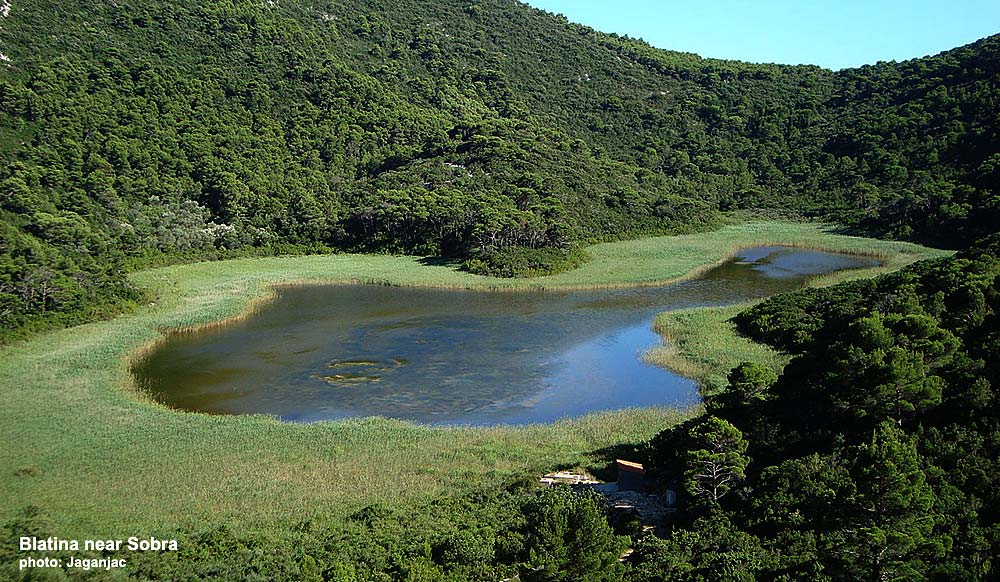
On the island of Mljet, there are another two similar but much smaller lakes, Blatina, one is in the vicinity of Sobra, also called Blatina, and another one, called Slatina, not far from Kozarica (see it here).
Location map of Blatina on Mljet:

GPS location coordinates of all three Blatina: Marker A: 42.767925, 17.461604; Marker B 42.774318, 17.466655, Marker C 42.731688, 17.600034
Places on Mljet
- Pomena
- Sobra
- Govedari
- Kozarica
- Pristaniste
- Saplunara
- Polace
- Babino Polje
- Babine Kuce
- Ropa
- Maranovici
- Prozurski Porat / Luka
- Okuklje
- Blatina
- Sutmiholjska
- Blaca
About Mljet
- Getting to Mljet
- Getting Around
- Buses on Mljet
- Maps
- Weather
- History and Culture
- Hotels
- Apartments
- Camping
- Mljet National Park
- Large & Small Lake
- Beaches
- Walking & Hiking
- Cycling
- Kayaking
- News & Blog