Walking and Hiking on Mljet Island
There are numerous short and long(er) walking routes on the Island. Furthermore, the Island of Mljet has also 43 km long recently established a dedicated hiking trail that is split into four shorter routes which you can complete in succession, one route a day.
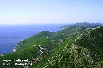
The trail features great views over the Island and neighboring sea channels as well as over Peljesac (the peninsula that is visible from the northern slopes, partly runs parallel with Mljet) and Lastovo the island that is visible from the southern slopes.
All four routes are clearly marked with distinguished signs at 20 checkings (control) points along each route. The map of the whole trail is available from Mljet Tourist Information Centre which you can get once you arrive on the island.
If you prefer to have your map in advance there is a much more detailed map you can buy it online. This map is definitely the best map you can get anywhere. It is a real hiking map (1:25.000) with very good markings and details – just the right format for hikers who prefer to plan their own routes over sticking to suggested hikes from guidebooks or local tourist offices.
I have this map and several other maps (for other islands) from the same publisher and I can recommend them without any hesitation. The map details are here
Here are suggested 4 walking routes that complete the whole 43 km trail:
Walking Route 1: Pomena to Govedjari

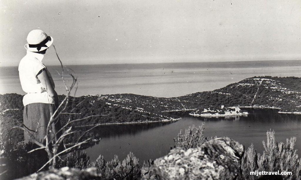
Walking Route 1 – a starting point for this route is in Pomena (see how to get here from Split or from Dubrovnik). This is a semi-circular route (see above map) that involves hiking along the Nothern part of National Park, passing and overlooking bays of Liskovje, Stupa, Bijela, Zaklopatica and Rogac, proceeding to the village of Govedjari. It takes an estimated 5 hours of walking. The whole walk is within the National Park boundaries. (See some historical photos of walking around Mljet). You can also see this part of the walk is the Map of Mljet National Park.
Walking Route 2: Govedjari to Blato

Walking Route 2: The starting point for this route is in Govedjari. This is a linear route (see map above) that connects Govedjari and Blato. It takes an estimated 7 hours of hilly walking. The first part of the route is within the National Park boundaries, while the final bit of the route proceeds out of the Park.
Walking Route 3: Blato – Rogovici – Babino Polje

Walking Route 3: The starting point for this route is Blato (a village in the center of the Island). The route is also linear, proceeding from Blato via Rogovici to Babino Polje (see above map). It takes about 6 hours to complete this, mainly the flat route. The whole walk is out of National Park boundaries.
Walking Route 4: Babino Polje – Veliki grad – Sobra

Walking Route 4: The starting point for this route is Babino Polje. The route is also linear, proceeding from Babino Polje via Veliki Grad (the very steep hill that offers great views) to the bay of Sobra (see above map). It takes approx 6 hours to complete this walk. The whole route is out of National Park boundaries.
If you decide to do some hiking on the island try not to miss Blatine, a small but deep lake situated in the three fields in the center of the Island – see more info and locations here
Places on Mljet
- Pomena
- Sobra
- Govedari
- Kozarica
- Pristaniste
- Saplunara
- Polace
- Babino Polje
- Babine Kuce
- Ropa
- Maranovici
- Prozurski Porat / Luka
- Okuklje
- Blatina
- Sutmiholjska
- Blaca
About Mljet
- Getting to Mljet
- Getting Around
- Buses on Mljet
- Maps
- Weather
- History and Culture
- Hotels
- Apartments
- Camping
- Mljet National Park
- Large & Small Lake
- Beaches
- Walking & Hiking
- Cycling
- Kayaking
- News & Blog